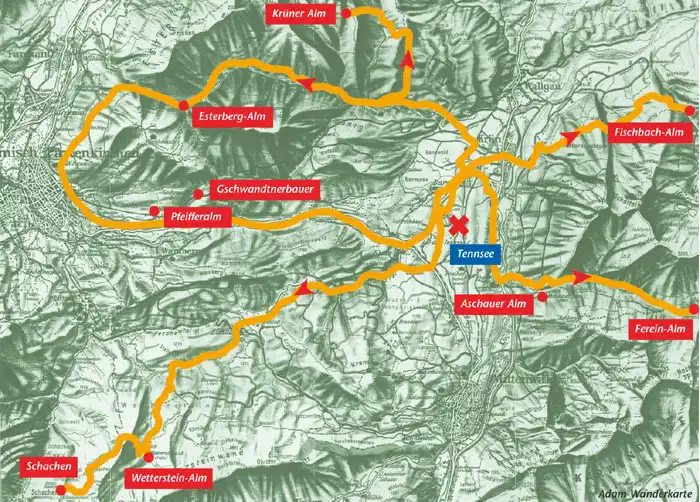
Hiking destinations in the Karwendel Alps

Leutascher Geisterklamm
A dramatic experience awaits you on two loop trails through the Geisterklamm gorge with interactive walk. Detailed information available …
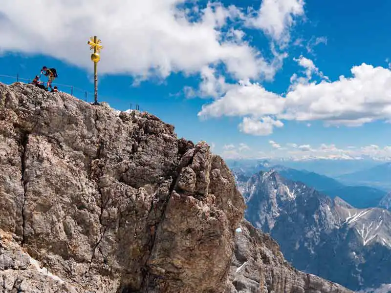
Zugspitze
The highest mountain in Germany (2962 metres), towering over Garmisch-Partenkirchen. Its vista offers a total of 400 peaks in 4 different countries.
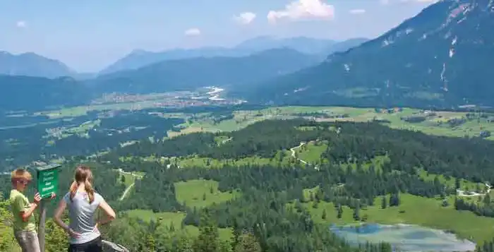
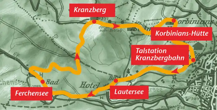
Kranzberggebiet
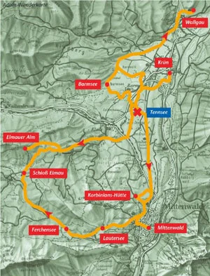
Kranzberg region – hiking loop approx. 6 hours, for children 7 and up: Start by driving to the valley station of the Kranzbergbahn chairlift in Mittenwald and follow the path to Lautersee / Ferchensee lakes. Once at Lautersee, stay on the right side of the lake so as to climb up on the right toward Ferchensee at its far end. After cresting the hill, follow the road down to Ferchensee lake. At the far end of the lake, turn right to climb the Hohen Kranzberg path. The mountain panorama awaiting you offers breathtaking views of the formidable Karwendel mountains, the Arnspitze peaks, the Wetterstein mountains and Zugspitze, and everything else in-between from Wank to Krün to Wallgau. Mittenwald lies right at your feet. From here, descend toward St. Anton and the Korbinians-Hütte lodge. After a refreshing respite, return to the Kranzberg chairlift station. (Estimated hiking loop approx. 6 hours; also suitable for children 7 and up)
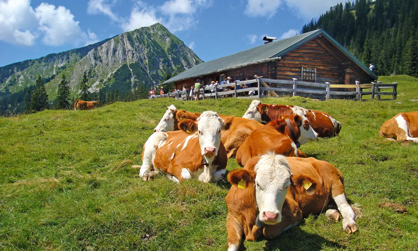
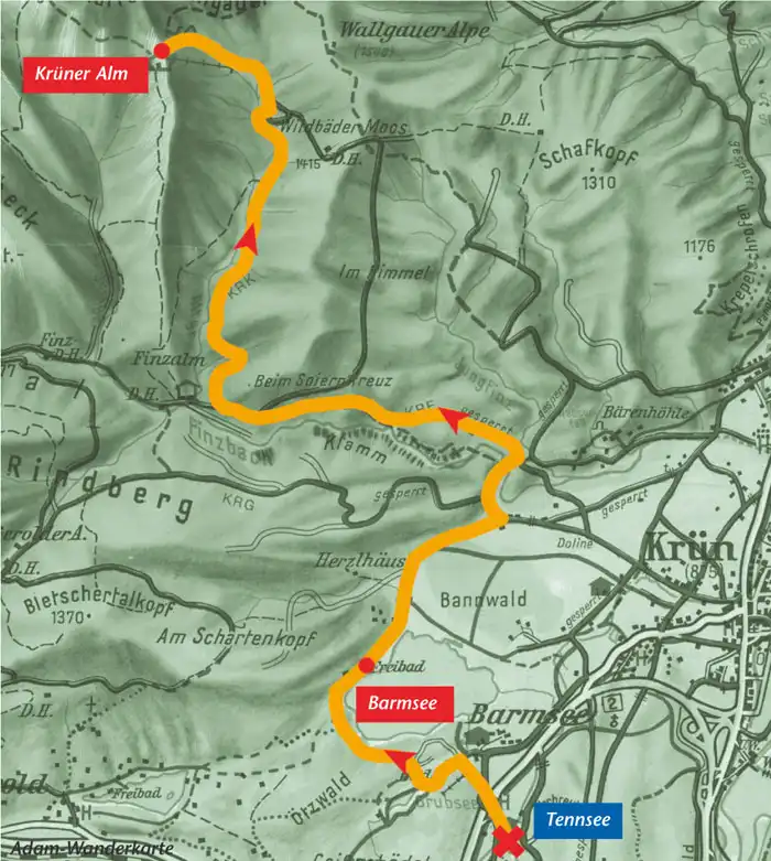
Krüner Alm
approx. 4 hours, for children 8 and up: Leaving the campground on foot, head around Barmsee in the direction of Wallgau. After the woodlands, turn onto the logging road on your left (to Rindberg). After about 250 metres, follow the trail on the right to Finzbachklamm. After descending down to and crossing the river channel, climb the steps on the other side and on up to a logging road a few minutes past. Turn left. Follow this logging road and the signs to Krüner Alm until the utility cableway. Climb the fields for a few minutes under the cableway until the Krüner Alm rises from a meadow in front of the peaks of the Krottenkopf (approx. 4 hours). Return via the same route. (suitable for children 8 and up)
Loop trail
Loop trail: Klais – Elmau – Ferchensee – Lautersee – Mittenwald – walkway (approx. 6 hours): Take the same route to Schloß Kranzbach as described above then stay briefly on the road between Klais and Schloß Elmau before turning right onto the footpath before the next rise. This path leads to the meadows below Schloß Elmau. Take the road up to the palace and then follow the footpath on your left past the palace toward Ferchensee, Lautersee and Mittenwald. The path leads along the Ferchenbach brook in the shadow of the Wetterstein mountains. Atop the hill past Ferchensee lake (nice spot to enjoy a rest), turn onto the footpath on your left heading down toward Lautersee lake (another nice spot to rest). Beyond Lautersee on the left, take the footpath to the valley station of the Kranzberg chairlift from which you can head down to Mittenwald.
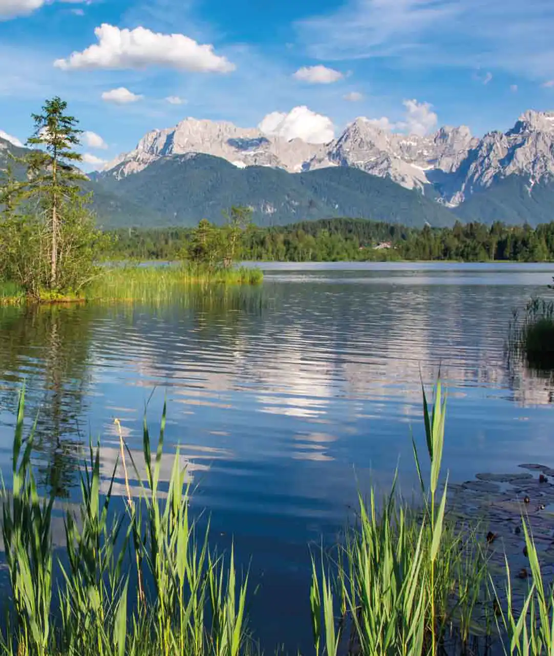
Barmsee / Maxhütte
Barmsee – Wallgau path (approx. 2 Std.) – further on to the Maxhütte inn (approx. 30 min.): Pass under the main road toward Barmsee, veer left toward Grubsee/Barmsee and follow the signs over the hill to Barmsee lake. Once past the lake, follow the logging road to Wallgau. If you veer to the right again after Barmsee, you can take the loop trail around Barmsee and back to where you started. Pass through Wallgau and follow the signs to the Maxhütte inn for a spectacular view over the entire upper Isar valley.
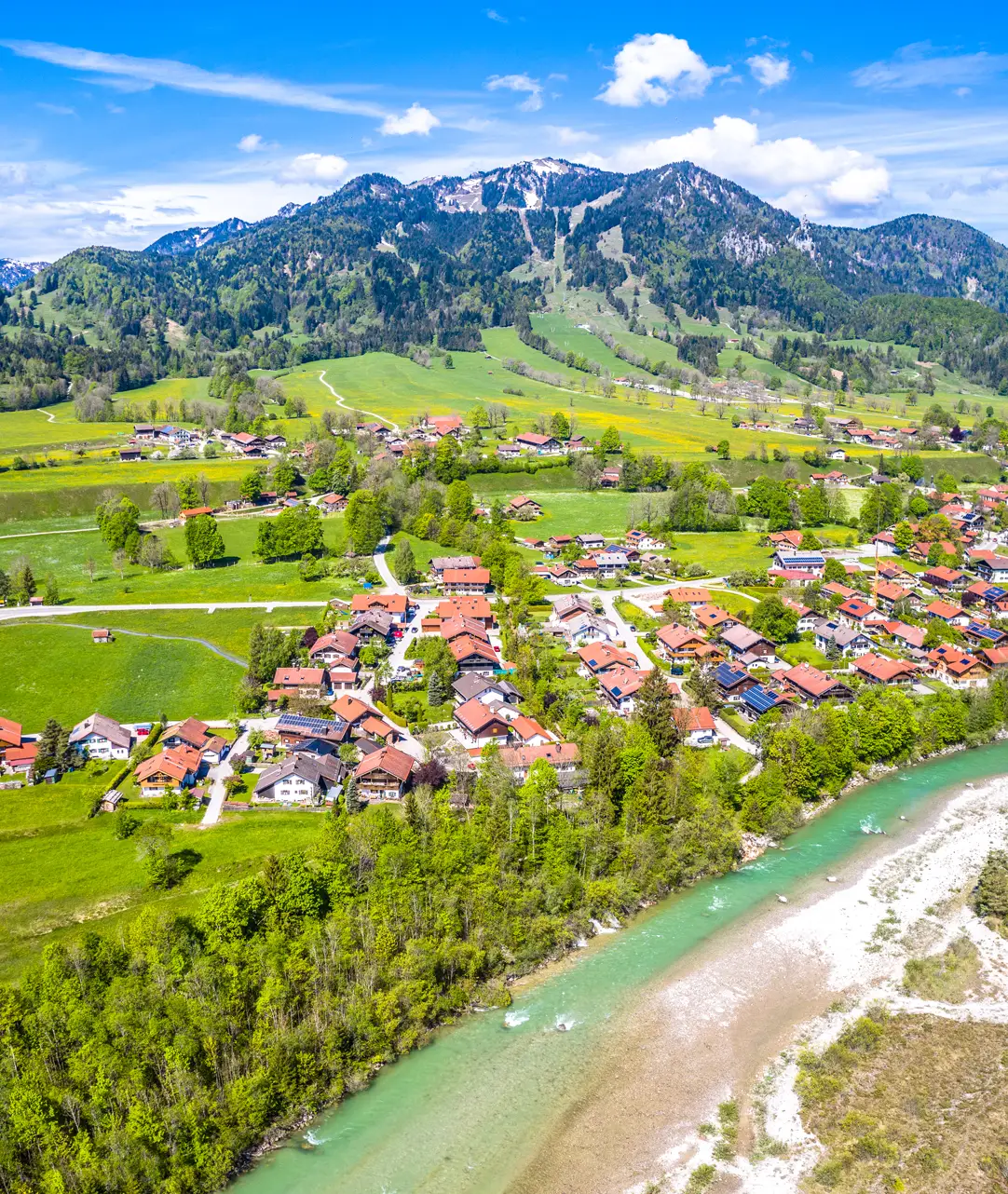
Brauneck
Between the Loisach and Isar rivers, just a stone’s throw from Munich, is one of the most beautiful day trip destinations in the Bavarian Alps – the Brauneck mountains.
Looking out from 1555 metres, visitors have the stunning splendours of the Isarwinkel region laid out at their feet. The restaurant directly above the Brauneck gondola station not only indulges you with spectacular panoramic views but also outstanding regional specialities. With just a little luck, an early morning hike or one of the more than 200 climbing routes here will reward you in a chance encounter with an indigenous Alpine ibex in the wild.
Paragliders and hang-gliders treasure Brauneck as a consistently good spot for thermal lift and optimum take-off and landing conditions. Regardless of whether your interests lie in hiking, climbing, flying or simply enjoying an unspoilt slice of nature, plan to experience the charm of this authentic and picturesque region – where Bavaria’s mountains are the prettiest!
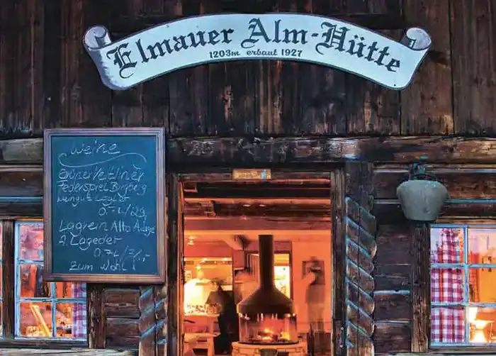
Klais / Kranzbach / Elmauer Alm
Walk Klais – Kranzbach – Elmauer Alm path (approx. 3 hours): Leave from the southwest corner of the campground and follow the path over the two hills until you reach the railway tracks. Cross over the tracks and then left down to the road between Klais and Mittenwald. Turn onto the logging road toward Kranzbach. Stay on this logging road past a small ostrich farm and across Kranzbach brook until you reach the road between Klais and Elmau. Cross this road and then follow the logging road on the other side, continuing uphill until a small path branches off to the left toward the Schloßhotel Kranzbach. Continue past Schloßhotel Kranzbach, heading in the direction of the road toward Elmau. Once you reach the road, veer right onto another logging road and follow it to the Elmauer Alm. (Hiking shoes strongly recommended as portions of the path are waterlogged after rains).
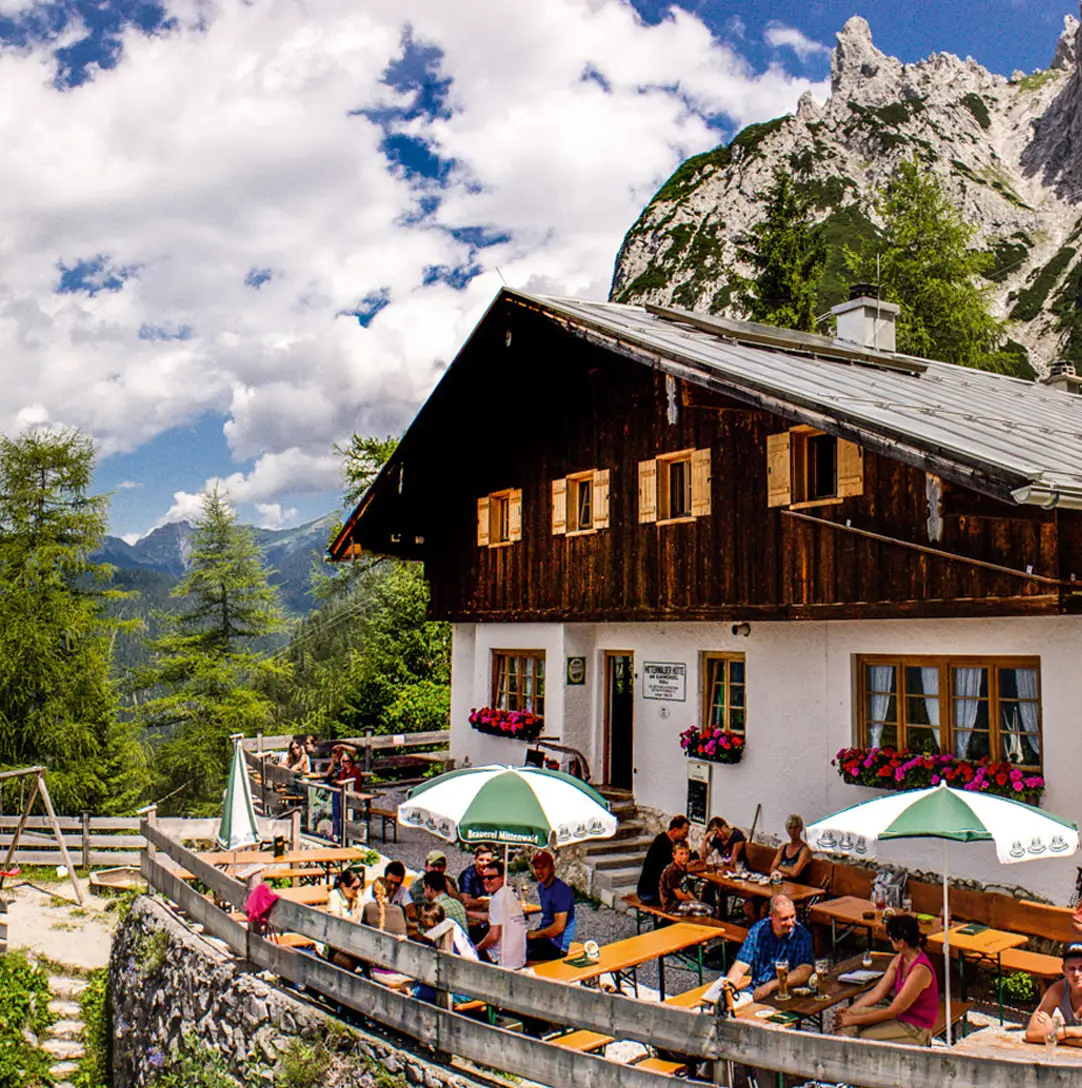
Mittenwalder Hütte
Approx. 4 hours, for children 5 and up: This excursion starts at the valley station of the Karwendelbahn gondola. At the entrance to the gondola, cross the road and briefly follow a stream to the steps up to the footpath. Follow the path along the edge of the slope. Signs then point in the upward direction toward Mittenwalder Hütte (approx. 2 hours further). Perched seemingly atop the world, you are rewarded with a stunning view of the violinmaking village and its surroundings. Even on the hottest of days, this hike is always a pleasantly cool ascent. Return via the same route. (suitable for children 5 and up)
Hochstraße – Mittenwald
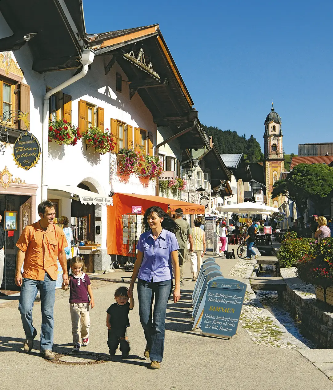
Hochstraße – Mittenwald, walking path, approx. 2 hours: Halfway around the Tennsee, veer to the left upward onto the small footpath and through the woods along the road. Turn right onto Hochstraße toward Tonihof to take in the magnificent panorama between Karwendel and Wetterstein. After passing Tonihof, head down to Schmalensee lake, skirting it on the left toward Mittenwald. Once atop the small rise where the road between Klais and Mittenwald intersects the path, cross the road and follow the curving road toward Luttensee. At the next road junction, turn left toward Gröblalm and descend via Gröblalm to Mittenwald. You’ll pass the church and the upper market square (Obermarkt) with its beautiful wall paintings. From here, the free hiking shuttle bus can whisk you back to Tennsee or you can take the train back to Klais.
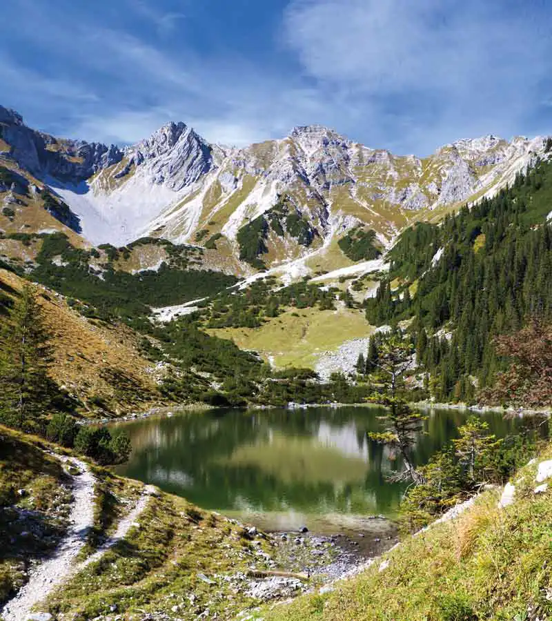
Soierngebiet
2-day hike for children 7 and up: Starting point for this 2-day hike is the hiker’s car park on the Isar river in Krün. Cross the Isar over the bridge past the sawmill and follow the lane to the left toward Fischbachalm. Follow the road up for approx. 2 hours until you see the Fischbachalm inn on the road’s highest point toward the left. After indulging in a short rest, it’s just about another 2 hours to the narrow Lakaiensteig trail along the mountain to the Soiernhütte lodge (hikers prone to vertigo will prefer taking the Hundstall route to Soiernhütte). Once settled into your overnight accommodations, take in your gorgeous location above two mountain lakes, which will hopefully give you a boost of energy for an evening stroll. The next morning, your ascent to the Schöttelkarspitze peak will take approximately 2 hours following the switchbacks above the lodge. As you climb, look forward to encountering many goat antelope – don’t forget your camera! A narrow trail leads across the Schöttelkarspitze to the Feldernkreuz and further to the right along the edge to Seinskopf (approx. 2 hours). This is where your descent to Krün starts via Felsenköpfl and Schwarzkopf and back to your automobile (approx. 2 hours). (suitable for children 7 and up)